The Draw
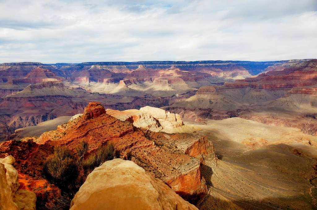
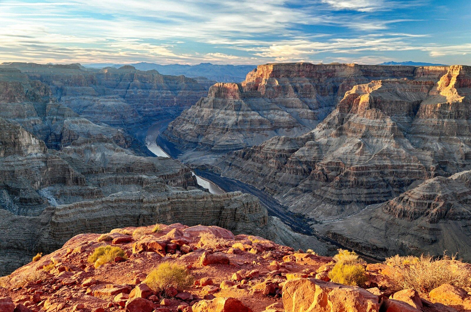
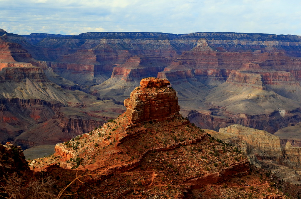
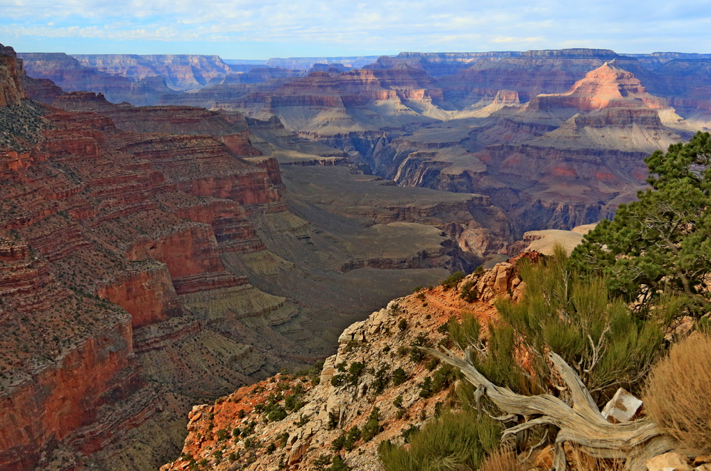
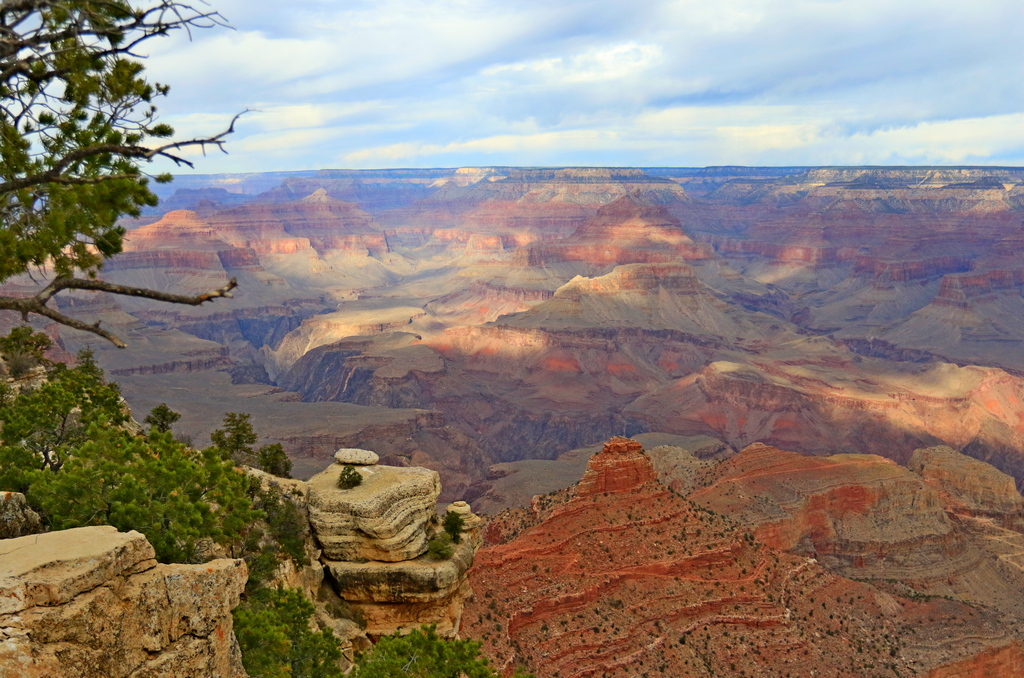
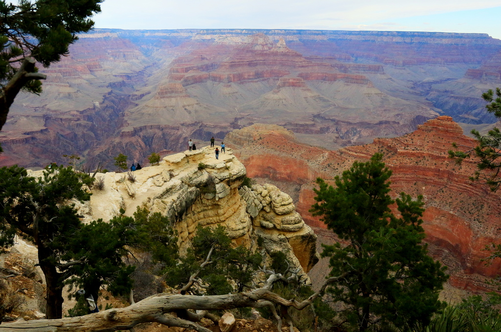
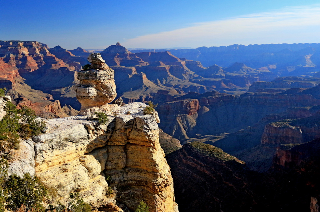
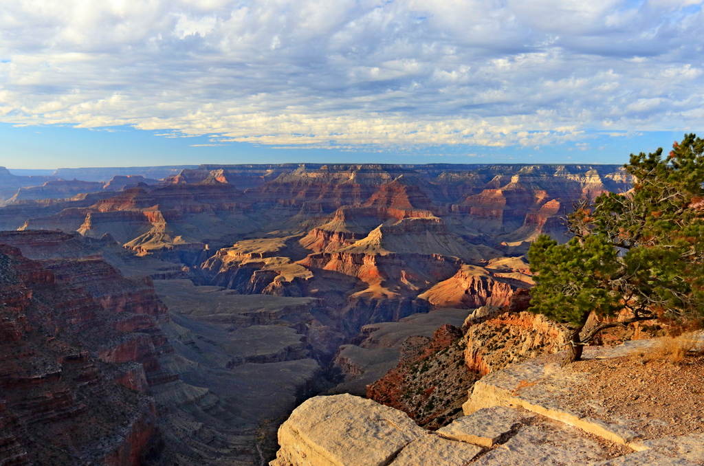
The Grand Canyon is not just a crack in the ground; it is a mind-bending, 277-mile-long geological cathedral that exposes 1.2 billion years of Earth's chaotic history. Plunging over a mile deep and stretching up to 18 miles wide, the sheer scale of the South Rim will literally stop you in your tracks, making you realize exactly how tiny we are in the grand scheme of the universe. It is a UNESCO World Heritage site and consistently ranks among the top natural wonders of the globe, demanding nothing less than your absolute awe. If you want face-melting vistas, vertigo-inducing trails, and sunsets that look painted by the cosmos, this is your ultimate pilgrimage.
The Map & Geography
The South Rim is the most accessible, most developed, and most iconic section of Grand Canyon National Park. Situated in northern Arizona, the park is divided into two primary access zones on this side of the chasm.
- Interactive Map Link: Explore Grand Canyon South Rim
- South Entrance Station (Near Tusayan): This is the primary gate (35°58'22"N 112°07'38"W) arriving via Highway 64 North. It gets severely backed up in peak summer; arrive before 8:00 AM or after 4:00 PM to avoid a multi-hour queue.
- East Entrance Station (Desert View): Located about 25 miles east of Grand Canyon Village via Highway 64 West from Cameron, AZ. This entrance is far less crowded, offers immediate panoramic pull-offs, and provides the dramatic build-up as you approach the canyon.
Climate & Weather
The South Rim sits at a high-desert elevation of around 7,000 feet, which means it gets real winters and scorching summers—especially as you descend into the canyon where temperatures spike dramatically. The absolute best times to visit are mid-spring (April-May) and fall (September-October) for perfect hiking weather and manageable crowds.
| Month / Season | Avg. High | Avg. Low | Precipitation / Conditions | Seasonal Notes (Crowds, Closures, Microclimates) |
|---|---|---|---|---|
| Spring (Mar - May) | 50°F - 70°F | 25°F - 39°F | Low rain, high winds. | Crowds begin to swell. Excellent hiking temperatures, but icy patches may linger in shadows on trails early in the season. |
| Summer (Jun - Aug) | 80°F - 85°F | 45°F - 50°F | Monsoon season (July-Aug). Sudden, intense afternoon thunderstorms. | Peak crowds. Inner canyon temperatures regularly exceed 100°F—hiking to the river during midday is strictly advised against due to heatstroke risk. |
| Fall (Sep - Nov) | 50°F - 75°F | 25°F - 43°F | Crisp, clear, and dry. | The absolute sweet spot. The lighting is magical for photography, crowds thin out significantly by late October, and inner canyon temps are glorious. |
| Winter (Dec - Feb) | 40°F - 45°F | 15°F - 20°F | Snow is common; beautiful but icy. | Lowest crowds. South Rim remains open, but trails require crampons/microspikes. Fog or snowstorms can temporarily obscure the canyon completely. |
Travel Logistics & Transit to Destination
- Minimum Days Needed: 3 Days (Ideal: 4-5 days) - You need one day for the rim viewpoints, one full day for a descent below the rim (even just partway), and one day to explore the Desert View Drive, stargaze, and soak in the history without rushing.
- Required Passes/Fees: $35 per vehicle (valid for 7 days). Major 2026 Update: Starting Jan 1, 2026, international tourists aged 16+ must pay a $100 per person foreign visitor surcharge on top of standard fees. Backcountry camping (e.g., Phantom Ranch/Bright Angel Campground) requires highly competitive, lottery-based permits booked months in advance.
- Real-Time Alerts: Always check the NPS Grand Canyon Conditions Page for trail closures, water station outages (frequent in summer!), and shuttle schedules.
How to Get There
The South Rim is remote, but a well-oiled tourism machine makes accessing it relatively straightforward if you plan ahead.
| Travel Mode | Primary Hub / Route | Est. Duration | Pros & Cons | Seasonal Limitations |
|---|---|---|---|---|
| Plane | Phoenix Sky Harbor (PHX) or Harry Reid Las Vegas (LAS) | 3.5 - 4.5 hours drive from airports | Pros: Massive flight availability. Cons: Still requires a long rental car drive to the actual park. | Year-round. Flagstaff (FLG) is closer but flights are expensive and prone to winter delays. |
| Car/Drive | I-40 to Williams, then AZ-64 North | 3.5 hrs from Phoenix, 4.5 hrs from Las Vegas | Pros: Total freedom to explore Desert View Drive. Cons: Summer traffic at the entrance gate and fighting for parking. | In winter, AZ-64 can occasionally be icy, but it is plowed regularly. |
| Train | Grand Canyon Railway (From Williams, AZ) | 2 hours 15 mins (each way) | Pros: Vintage, incredibly fun, zero parking stress at the rim, drops you in the historic village. Cons: Strict schedule dictates your rim time. | Runs year-round, with the famous "Polar Express" operating in winter. |
Budget & Cost Expectations
- Relative Cost Index: High. Like most bucket-list National Parks, proximity comes with a premium. Lodging inside the park is expensive and dining is marked up.
- Estimated Daily Spend:
- Budget: $75-$100 (Camping, grocery store sandwiches, free shuttle use).
- Mid-Range: $200-$350 (Staying in Tusayan/Williams, casual dining, one guided tour).
- Luxury: $500+ (El Tovar Hotel, fine dining, private helicopter tour).
- Cultural Basics: English is standard. The park is highly cashless—credit/debit is required at entrance gates and most lodges. Standard US tipping (15-20%) applies at sit-down restaurants in the village and gateway towns.
Local Transit & Regional Passes
Once you are in the park, park your car and leave it. The South Rim operates a phenomenal, free shuttle bus system that is mandatory for certain areas (like Hermit Road in summer). The Blue Line connects the Village and Visitor Center, the Orange Line runs to Kaibab/Rim viewpoints, and the Red Line takes you out to Hermit's Rest. The Purple Line even runs to the gateway town of Tusayan during peak summer, meaning you don't even need to drive into the park.
In-Park Camping Details & Reservations
Camping at the South Rim is the ultimate way to immerse yourself in the ponderosa pine forests while staying mere minutes from the rim. Because of its global popularity, securing a site requires exact timing and advanced planning.
- Mather Campground (Tents & Dry RVs): Located in the heart of Grand Canyon Village. This massive, tree-shaded campground offers 327 sites. There are no hookups, but there is a dump station, free shuttle access, and nearby pay showers/laundry.
Booking Strategy: Highly competitive. Reservations open on a rolling 6-month rolling window at 10:00 AM EST (8:00 AM MST). During peak season (March 1–Nov 30), it sells out instantly. The "Pine Loop" is strictly generator-free.
Link: Reserve Mather Campground - Desert View Campground (Tents & Small RVs): Located 23 miles east of the Village at the East Entrance. It offers 49 dry sites and is a quieter, less chaotic alternative to Mather. Max RV length is strictly 30 feet.
Booking Strategy: Open seasonally (mid-April to mid-October). Reservations are required and open on a 6-month rolling window via Recreation.gov. No first-come, first-served sites are held back.
Link: Reserve Desert View Campground - Trailer Village RV Park (Full Hookups): The only in-park option with full water, sewage, and electrical hookups. Accommodates RVs up to 50 feet.
Booking Strategy: Run by the concessionaire Delaware North. You can book up to 13 months in advance. Book exactly a year out for summer slots.
Link: Reserve Trailer Village
Where to Stay (Lodging & Base Camp Hubs)
Booking windows are fierce here. In-park lodging opens 13 months in advance and sells out almost instantly.
| Base Camp Area | Hub Category | Drive Time to Site | Vibe & Best For | Lodging & Dining Density | Map Link |
|---|---|---|---|---|---|
| Grand Canyon Village (In-Park) | Immediate Gateway | 0 mins (You're on the rim) | Historic, immersive, unmatched sunrise access. Best for early hikers and photographers. | Six historic lodges (El Tovar, Bright Angel). Expensive, zero vacancy without planning. Limited dining. | Map Link |
| Tusayan, AZ | Primary Gateway Town | 15 mins | Convenient, tourist-centric. Best for those who missed in-park lodging but want to be extremely close. | High density of chain hotels and standard American/Mexican restaurants. Can be pricey. | Map Link |
| Williams, AZ | Route 66 Gateway | 60 mins | Retro, charming Route 66 vibes. Best for budget travelers and train enthusiasts. | Dozens of motels, breweries, and classic diners. Excellent value. | Map Link |
| Flagstaff, AZ | Mountain City Hub | 1.5 hours | College town energy, mountain pine setting. Best for foodies, craft beer lovers, and extended trips. | Huge variety of Airbnbs, boutique hotels, stellar dining, and breweries. | Map Link |
Interesting & Unique Culinary Experiences
- Iconic Regional Flavors: You are in the Southwest. Navajo Tacos (fry bread topped with chili and fixings), prickly pear anything (margaritas, syrups), and hearty elk chili are absolute staples of the region.
- El Tovar Dining Room: An upscale, historic dining experience right on the rim. The dining room feels like a 19th-century hunting lodge. Try the French Onion Soup Gratinée or the sustainable salmon. Logistics: Advanced reservations are strictly required for dinner. Dress code is "casual but neat" (no dirty hiking gear if you can help it).
- Arizona Steakhouse (Bright Angel Lodge): Unpretentious, massive windows facing the rim, and excellent ribeye. The wait can be brutal, so put your name in right as you finish your late afternoon hike.
- Phantom Ranch Canteen: The most exclusive meal in the park—because you have to hike or ride a mule to the very bottom of the canyon to get it. Their legendary stew and steak dinners must be reserved months in advance.
Top Sights, Iconic Highlights & Hidden Gems
Do not just stare at the canyon from one spot. The light shifts constantly, revealing new depths, colors, and shadows as the day progresses.
| Attraction | The "Why" (Highlight & Expert Insider Tip) | The "When" (Best Time & Duration) | Logistics & Safety | Map & Transit |
|---|---|---|---|---|
| Mather Point | The absolute classic first view. It’s breathtaking, but usually packed. Insider Tip: Walk half a mile west along the Rim Trail to escape 80% of the crowds while keeping the exact same view. | Sunrise. Spend 30-45 minutes. | Extremely safe, paved, fully fenced. Right behind the main Visitor Center. | Map Link |
| Desert View Watchtower | A striking stone tower designed by Mary Colter in 1932. It offers the best view of the Colorado River cutting through the eastern gorge. | Mid-day to Late Afternoon (1-2 hours) | Access via personal vehicle on AZ-64 East. No shuttle service here. | Map Link |
| Yavapai Geology Museum | A masterclass in canyon formation with massive panoramic windows. Insider Tip: Use their topographic relief maps to trace the trails you plan to hike. | Mid-day (when the sun is hottest, seek AC here). | Accessible via Orange Shuttle or short walk from Mather. | Map Link |
| Shoshone Point (Hidden Gem) | One of the only viewpoints not marked with heavy signage. It requires a 1-mile flat dirt walk through pine forest to reach a spectacular, quiet rock outcropping. | Sunset (2 hours total). Pack a picnic. | Dirt parking lot off Desert View Drive. Unfenced edges—keep kids close. | Map Link |
| Hermit's Rest & Hermit Road | A stunning 7-mile scenic route dotted with legendary overlooks (Hopi Point for sunset is unmatched). | Late afternoon into Sunset. | Closed to private vehicles Mar-Nov. You MUST use the Red Route shuttle or rent a bike. | Map Link |
Guided Tours & Bookable Excursions
To truly comprehend the canyon, sometimes you need to get above it, or ride a sturdy beast of burden down into it.
| Excursion / Tour Name | Provider / Type | Why It's Worth It | Est. Cost | Booking Link |
|---|---|---|---|---|
| Grand Canyon Helicopter Tour | Papillon or Maverick (Aerial) | You cannot understand the true scale until the ground drops away beneath you at the North Rim. It is a jaw-dropping, emotional 45-minute flight. | $250 - $350 | Papillon |
| Mule Ride to the Bottom | Xanterra (Historic Mule Ride) | The most famous excursion in the park. A terrifying, thrilling, and historic way to reach Phantom Ranch without wrecking your knees. | $1000+ (Overnight packages) | Grand Canyon Lodges |
| Pink Jeep Sunset Tour | Pink Jeep Tours (Guided Drive) | Expert guides drive you in open-air Wranglers to the best viewpoints, explaining the geology, biology, and history in a highly entertaining way. | $120 - $150 | Pink Jeep Tours |
Trail Guide for Hiking Lovers
Going down is optional; coming up is mandatory. The Grand Canyon is an inverted mountain. Do not underestimate the brutal return climb, the intense heat, or the lack of shade. Note: Hiking rim-to-river-to-rim in a single day is highly discouraged and can be fatal.
| Trail Name | Distance (Round Trip) & Est. Time | Level of Effort / Difficulty | Terrain, Hazards & Key Highlights | Map & Trailhead |
|---|---|---|---|---|
| The Rim Trail | Up to 13 miles (Customizable) | Easy / Flat | Paved, largely accessible path skirting the edge. No water hazards, perfect for families and massive sweeping views. | Map Link |
| South Kaibab to Ooh Aah Point | 1.8 miles (1.5 - 2 hours) | Moderate (Steep climb back) | Zero shade, steep switchbacks. Offers the fastest, most dramatic, 360-degree expansive views of any trail on the rim. | Map Link |
| South Kaibab to Cedar Ridge | 3 miles (2.5 - 4 hours) | Strenuous | Exposed ridgeline descent to a striking red-dirt plateau. Pit toilets available. No water available on this entire trail. | Map Link |
| Bright Angel Trail to 1.5-Mile Resthouse | 3 miles (2.5 - 4 hours) | Moderate to Strenuous | Follows a natural fault line. Shadier than Kaibab. Seasonal water available. A classic, well-maintained descent. | Map Link |
| Bright Angel to Havasupai Gardens | 9 miles (6 - 8 hours) | Very Strenuous | A punishing climb out. Rewards with a lush, green desert oasis in the middle of the canyon. A massive accomplishment for fit day hikers. | Map Link |
| Grandview Trail (To Horseshoe Mesa) | 6 miles (5 - 7 hours) | Extremely Strenuous | Rugged, unmaintained, steep, and treacherous cobblestones. For experienced canyon hikers only. Stunning historic copper mining remnants. | Map Link |
Night Sky & Stargazing Experience
- Dark Sky Rating: The Grand Canyon is officially certified as an International Dark-Sky Park (as of 2019). With over 95% of the park's lighting upgraded to dark-sky compliant fixtures, it is one of the last places in the US where you can witness a pristine Milky Way.
- Prime Viewing Locations:
- Mather Point: Convenient, but can have ambient village light.
- Moran Point & Lipan Point: Unmatched views facing deep into the canyon abyss with zero light pollution along Desert View Drive.
- Shoshone Point: If you are brave enough to walk the 1-mile trail in the pitch dark, you will have the cosmos entirely to yourself.
- Optimal Timing: You must plan around the moon phase! Target a New Moon or Third Quarter phase. Stargaze at least 1.5 hours after sunset. Also, attend the massive Grand Canyon Star Party held annually in June, where astronomers set up dozens of telescopes.
- Stargazing Tips: Temperatures plummet the second the sun goes down (even in summer, it gets chilly). Bring heavy layers. CRITICAL: Use a red-light flashlight or headlamp. Red light preserves your night vision; white light ruins it for you and everyone around you.
General Trip Packing & Activity-Specific Kits
The Grand Canyon is a high-altitude desert environment that demands respect. Your standard city walking shoes will not cut it on the rim, and cotton t-shirts will betray you in the heat.
| Essential Gear Item & Brand Suggestion | Why You Need It For Grand Canyon South Rim |
|---|---|
| Hydration Pack (Osprey or CamelBak, 3L+) | Dehydration is the #1 cause of emergency rescues here. You need to carry a minimum of 3-4 liters of water if hiking into the canyon, as water pipelines often break unexpectedly. |
| Trekking Poles (Black Diamond or Leki) | The descents (especially South Kaibab) will absolutely shred your knees. Poles transfer load to your upper body and provide essential stability on steep, sandy switchbacks. |
| Wide-Brim Sun Hat & UPF Sun Hoodie | There is virtually ZERO shade on trails like South Kaibab. The high-elevation sun will cook you in minutes. A UPF 50+ hoodie (like Patagonia Capilene Cool) protects your skin and keeps you cool. |
| Microspikes/Crampons (Kahtoola) | (Winter/Early Spring Only) The top 1,000 feet of the trails are permanently cast in shadow during winter, turning the switchbacks into a literal ice chute. Do not attempt trails without traction. |
| Red Light Headlamp (Petzl or Black Diamond) | Crucial for navigating the rim safely after sunset, catching the sunrise, and preserving night vision while enjoying the Dark Sky Park. |
Health & Eco-Safety Check
- First-Aid Essentials: Blister care (moleskin or Leukotape) is absolutely non-negotiable. Bring electrolyte powder (Liquid I.V. or Nuun)—drinking plain water without replacing salts leads to hyponatremia, a deadly condition highly common in the canyon. Include tweezers for cactus spines.
- Wildlife Safety: Do not approach the Elk or the Rock Squirrels. The squirrels carry diseases and are notoriously aggressive biters when tourists attempt to feed them. The Elk are massive and will charge if provoked. Keep a 50-foot distance.
- Leave No Trace: Pack out all trash, including orange peels and toilet paper (if using remote areas). The desert environment takes decades to break down organic matter.
References & Official Resources
- National Park Service - Grand Canyon Official Site: nps.gov/grca
- Current Park Conditions & Trail Alerts: NPS Conditions
- Grand Canyon Conservancy (Dark Sky Information): grandcanyon.org
- Grand Canyon Lodges & Mule Ride Booking (Xanterra): grandcanyonlodges.com
- Backcountry Permit Office & Lottery: Backcountry Permits